Texas Maps
Showing 1 to 3 of 3 (1 Pages)

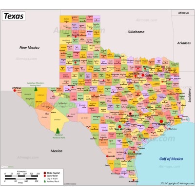
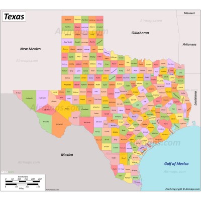
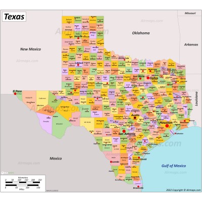
Texas is a state in the South Central region of the United States. Texas is the second-largest state by total area (268,596 sq mi (695,662 km2)) and the second-largest by population (30 million). Texas shares borders with the states of Louisiana to the east, Arkansas to the northeast, Oklahoma to the north, New Mexico to the west, and the Mexican states of Chihuahua, Coahuila, Nuevo León, and Tamaulipas to the south and southwest; and has a coastline with the Gulf of Mexico to the southeast.
Texas is divided into 254 counties, which is more than any other state. The largest city is Houston. Austin is the capital city of of Texas. San Antonio is the second-most populated city in the state.


